GeoX Ecosystem

Where location meets data.

Geospatial engineering, planetary raster laboratories and public digital applications.

Planetary & Earth Observation Labs

High-resolution elevation models, multispectral remote sensing pipelines, and 3D planetary terrain exploration.

Live on Cloudflare Pages Planetary Altimetry & 3D WebGL

GeoX Mars Explorer

Planetary terrain & geospatial analysis laboratory for Mars. — Not fully mobile adapted yet (work in progress)

Interactive 3D WebGL engine combining NASA MOLA global elevation data (16 ppd), USGS/CTX imagery, and high-resolution HiRISE/CTX terrain packages. Features mission traverse data for Perseverance and Curiosity, cross-sectional transects, and paleocean flooding simulations.
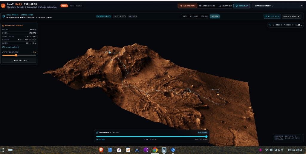
3D WebGL Terrain NASA MOLA 16 PPD CTX 5m & HiRISE DTM Rover Traverses Topographic Transects Cloudflare Pages
mars.geox.dev
Lab / Research Paleogeography & Isostasy

PalaeoCoast

Postglacial land uplift and shoreline displacement modeling.

Reconstructing millennia of coastal evolution across the Baltic Sea and Fennoscandia through integration of sedimentological data, digital elevation models, and glacial isostatic adjustment.

Postglacial Land Uplift Baltic Sea Evolution Paleo Shorelines DEM Reconstructions Quaternary Geology
palaeocoast.se
Lab / Pipeline Satellite Remote Sensing

Sentinel Lab

High-throughput Copernicus Sentinel-2 MSI Level-2A processing.

Automated extraction of 10-meter Bottom-of-Atmosphere (BOA) reflectance, Normalized Difference Vegetation Index (NDVI), burn severity (dNBR), and water indices directly from European Copernicus satellite acquisitions.

Copernicus Sentinel-2 10m BOA Multispectral NDVI Vegetation Health dNBR Fire Severity Automated Raster ETL
sentinel.geox.dev

Applications & Decision Support

Production platforms, public data portals, accessibility modeling, and developer tooling.

Pilot Decision Support • Accessibility • GIS

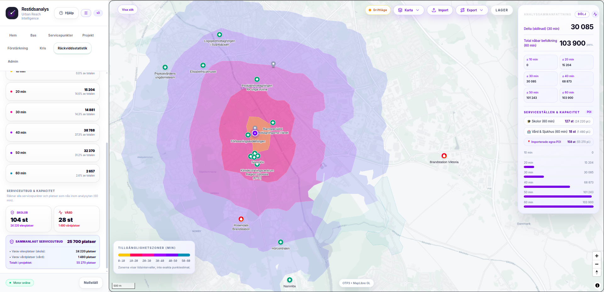
Restidsanalys

Analyze accessibility in travel time — not just distance.

Restidsanalys models multimodal travel-time isochrones and service catchment areas for public transit, cycling, walking, and driving — helping municipalities analyze healthcare and school accessibility.

Isochrones & Reach Multimodal Routing Disruption Scenarios Decision Support
restidsanalys.se
Live / Public Public Data • Election Analytics • Maps

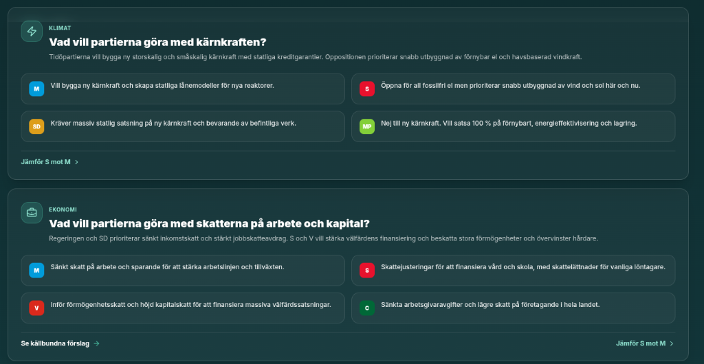
Valatlas

Explore Swedish election data from nationwide results to voting districts.

Combines official election results, party positions, municipal budgets, and demographic data to make Swedish political geography accessible and transparent.

Official Election Data Voting Districts Municipal Comparisons Interactive Cartography
valatlas.se
Live Demographics • Socioeconomics • Regional Data

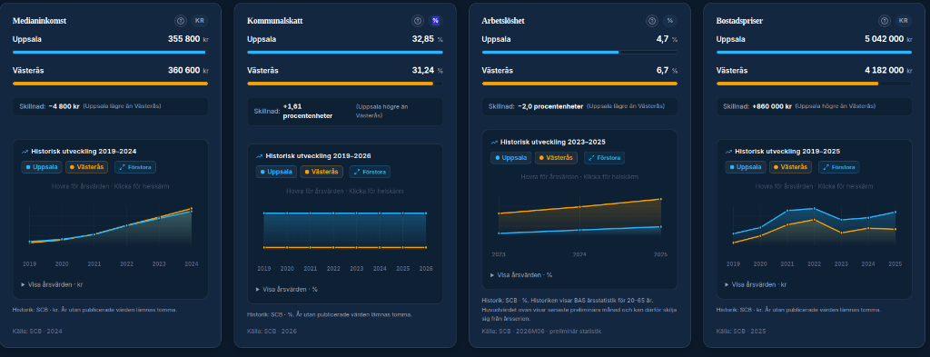
Områdesatlas

Explore Swedish society, economy, and geographic patterns through data.

An interactive regional atlas comparing demographic structure, employment, income levels, and socioeconomic indicators across municipalities and local districts.

Demographic Structure Socioeconomics Regional Indices Public Statistics
omradesatlas.se
In Development Developer Tools • AI Agent • Coding

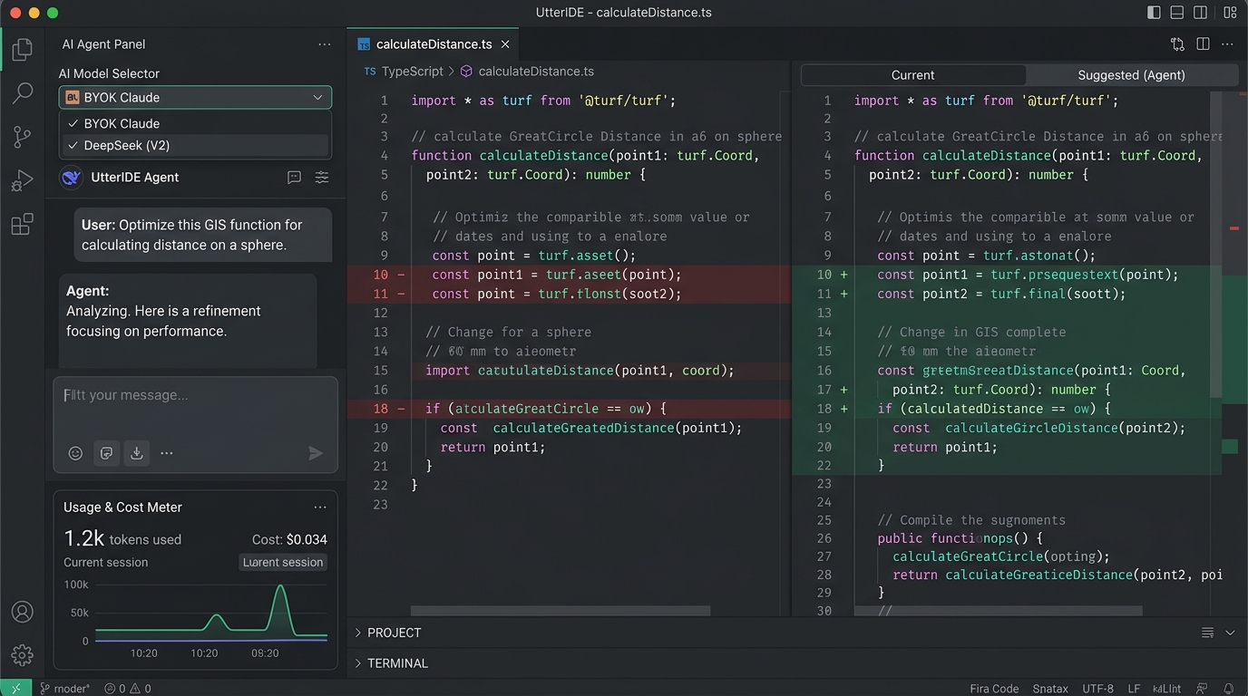
UtterIDE

Review-first AI coding agent with the developer in full control.

An experimental developer environment exploring review-first workflows, bring-your-own-key (BYOK) architecture, multi-model orchestrations, and granular inspection of automated codebase changes.

Review-First BYOK Multi-Model Local Control
utteride.se
Live Preparedness • Situation Map • Geodata

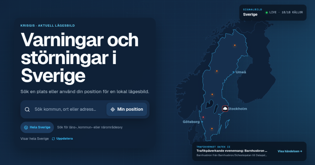
KrisGIS

Unified geographical situational awareness for crises and disruptions.

Aggregates verified public sources and open government geodata into a unified map interface, providing spatial overviews of disruptions, weather alerts, and civil infrastructure.

Situation Map Open Government Feeds Public Infrastructure Independent GIS
krisgis.se

Capabilities & Engineering Delivery

Production-grade geospatial engineering — from raw raster and vector pipelines to high-performance analytical web applications.

Spatial ETL & Automated Data Pipelines

Design and implementation of reproducible spatial processing pipelines that ingest, normalize, and validate large-scale geodata from authoritative providers into clean, analysis-ready formats.

FME · GDAL · Python · Schema Normalization · Vector Tiling · Open Data APIs

Interactive Web Mapping & Decision Support

Turnkey spatial interfaces, regional dashboards, and decision support platforms that translate multi-layered municipal, demographic, and election datasets into intuitive cartographic tooling.

MapLibre GL · Vector Tiles · Scalable GeoJSON · REST APIs · Modern Vanilla UI

3D WebGL & High-Performance Terrain

Client-side GPU visualization of planetary and terrestrial digital elevation models (DEM/DTM), dynamic hypsometric styling, cross-sectional transects, and sub-meter orbital mosaics with zero server GPU overhead.

Three.js · Custom Shaders · Client-Side LOD · DTM Hypsometry · Planetary Baselines

Satellite Remote Sensing & Spatial Analysis

Automated multispectral processing of Copernicus Sentinel-2 Level-2A imagery (NDVI, dNBR, BOA reflectance) paired with multimodal travel-time isochrones, network reachability, and disruption modeling.

Copernicus Sentinel-2 · Raster Math · Multimodal Isochrones · Network Analysis

About GeoX

GeoX is an independent development identity exploring the intersection of planetary altimetry, remote sensing, geospatial engineering, and digital products.